Faster 3D mapping
Drone capture creates orthophotos, DSM, and contour data much faster than traditional survey methods.
Enterprise IT Solutions
We provide aerial drone mapping and GIS survey services for fast, accurate area models that support infrastructure planning, construction, inspection, and agricultural monitoring. Our drone data is processed into orthophotos, DSM, contour maps, and GIS-ready layers for engineering teams.
Aerial drone mapping delivers a fast, wide-area view of your target site, reducing reliance on manual survey and accelerating site planning. This is ideal for land approvals, corridor inspection, industrial estates, and large construction projects.
Comprehensive data from a single flight helps project teams understand contours, elevation, and critical site features without stitching multiple datasets manually.
We start with location assessment and flight planning, then capture data with DJI, XAG, or Autel UAVs. Raw imagery is processed into orthophotos, DSM, contours, and control points ready for use.
Preparation includes flight authorization, geo-referencing, and quality checks so deliverables are production-ready for engineering and GIS teams.
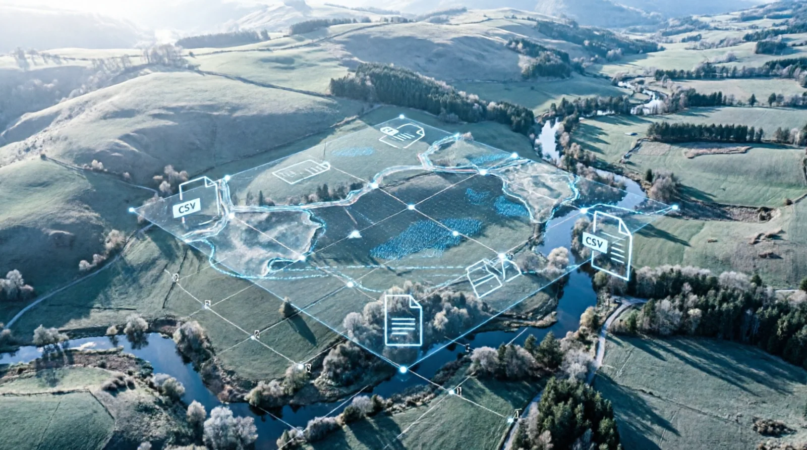
Drone mapping output is delivered as GIS layers, GeoJSON, and CSV files that can be imported into planning, design, or monitoring systems.
This supports site analysis, corridor planning, land mapping, and inspection documentation with data that is already structured.
Engineering teams get precise maps that help determine cable, network, or infrastructure routes with less field risk.
Operations and project stakeholders can evaluate site conditions faster because the data is presented clearly and ready for decision-making.
As an end-to-end technology partner, Intilogy combines drone expertise, geospatial processing, and GIS integration so you get not just maps but actionable datasets.
We support platform selection, safe field execution, data processing, and workflow integration for your team.
Infrastructure · Agribusiness · Property · Energy · Manufacturing
Key advantages
Fast, structured aerial data helps your project team make better site, design, and inspection decisions.
Drone capture creates orthophotos, DSM, and contour data much faster than traditional survey methods.
Deliverables are prepared for immediate GIS use by planning and engineering teams.
Drone surveys reduce manual on-site effort and keep field operations safer.
Consistent mapping data improves alignment across engineering, procurement, and project planning.
Service scope
From mission planning through GIS delivery, we support the full aerial mapping workflow.
Site assessment, flight planning, and authorization for safe mission execution.
Aerial data collection with DJI, XAG, or Autel for orthophotos and survey-grade datasets.
Create orthophotos, DSM, contours, and GIS-ready point data.
Provide data in GIS, CSV, or GeoJSON format plus technical reporting.
<p>Yes, we provide licensed UAV operators, flight planning, and processing for orthomosaic, DSM, and contour deliverables.</p>
<p>Absolutely. Drone mapping is ideal for crop health monitoring, acreage measurement, and irrigation planning.</p>
Our team supports assessment, recommendations, procurement, and documented implementation.